
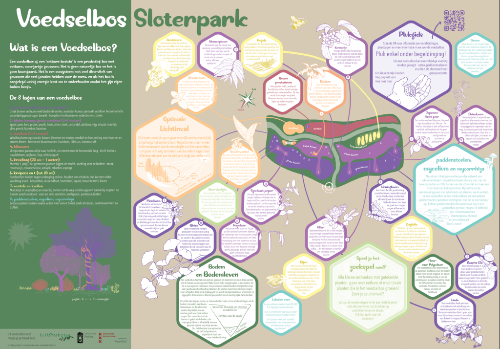
Every colour on the map refers to a different layer of the forest, both in the general “What is a Food Forest?” explanation on the left, and in the more specific bee-hive boxes about the plants that are planted in the Sloterpark Food forest.
Dark purple plants are large trees of over 8 meter. Lila is the big bushes and small trees of 3 to 6 meter. Both of these are placed in the north side of the food forest, in order to avoid their shades covering small plants sunlight.
Red are bushes, mostly berry bushes in this case. Orange are the herbal layer of 20 cm to 1 meter. Yellow visualized the ground covering plants that help the earth to stay moist without extra watering. A food forest is designed to have a self-sustaining ecosystem.
Light green are the optional root vegetables, and light blue the very important mushrooms of the ecosystem.